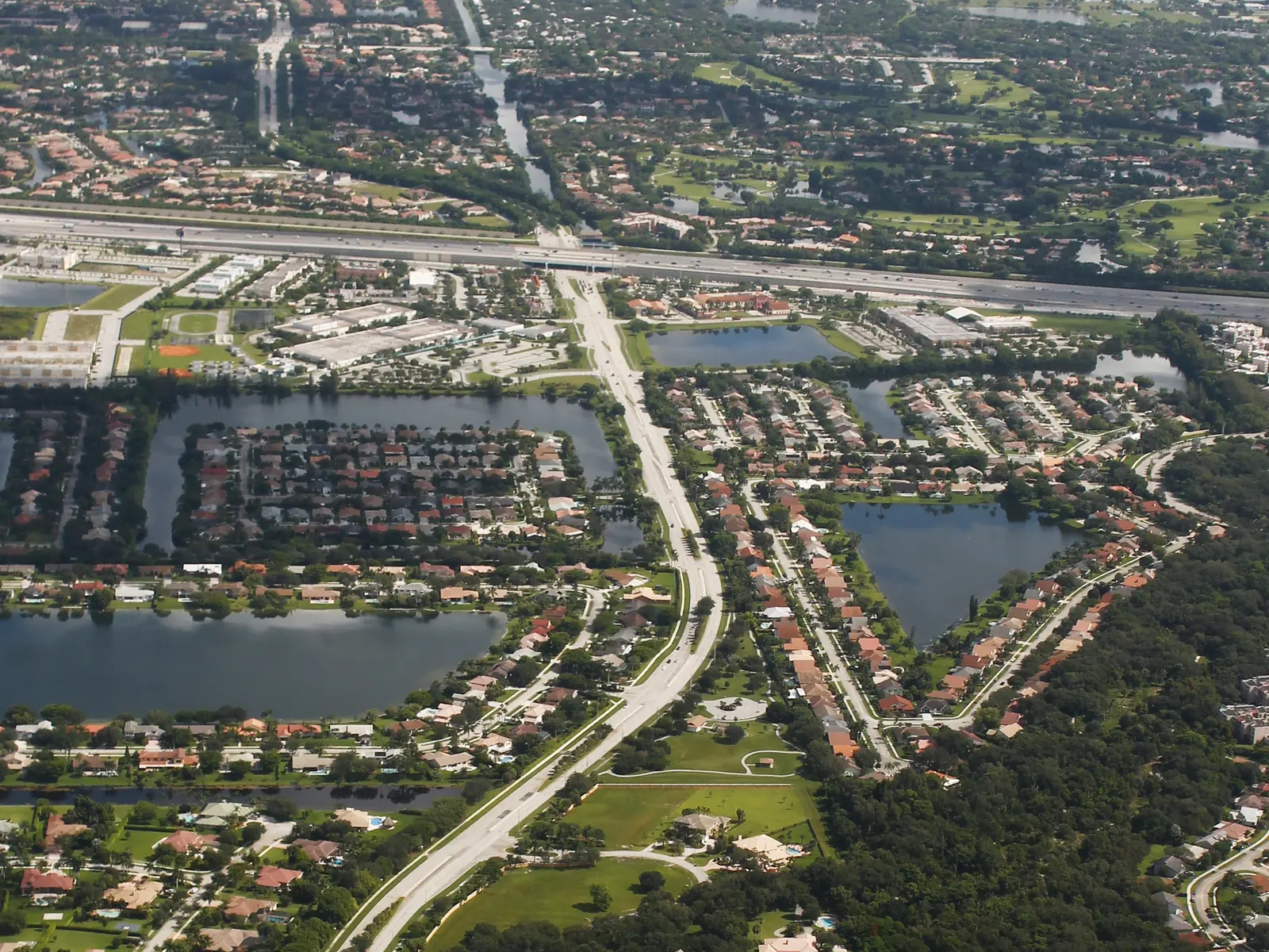
Pine Island Ridge sits between Nob Hill Road and University Drive south of Nova Drive. Zoned for Western High; ZIP 33328 value $626,047 in August 2026.
Last checked Oct. 8, 2026. Sources: the Town of Davie’s comprehensive plan and Pine Island Ridge Trail page, Broward County Public Schools’ 2025-26 attendance boundaries, the Florida Department of Education’s 2026 school grades, the Zillow Home Value Index and OpenStreetMap. Part of our Davie neighborhoods guide.
Pine Island Ridge is central Davie, built around the oak ridge that gives it its name. The town’s comprehensive plan calls it Planning Area 5 and says the ridge “has been preserved within this planning area by joint efforts with local, county, and state jurisdictions.” Homes range from 3 to 22 an acre, with shops and offices along University Drive and Orange Drive. OpenStreetMap labels the area “Pine Island Ridge.”
What this means for you
- Zoned high school: Western High (graded A for 2026) for almost every address. Confirm yours in Find My School.
- Home value: the typical home in ZIP 33328 was worth $626,047 in August 2026, Zillow says.
- Nearest interstate exits: I-595 Exits 4 (Nob Hill Road), 5 (Pine Island Road) and 6 (University Drive), about a mile north of Nova Drive.
Where it is
The plan bounds Planning Area 5 by Nova Drive on the north, University Drive on the east and Nob Hill Road on the west. The southern edge is SW 36th Street on the western part and Orange Drive on the eastern part. Pine Island Road runs through the middle.
The plan says single-family homes here are mostly in larger communities it names as Forest Ridge, Rolling Hills, Arrowhead Golf and Tennis Club and Pine Island Bay, and that apartment and condo developments are smaller, among them The Harvest, Isla Merita, Old Country Manor, Alpine Woods and Reflections.
ZIP codes: about nine-tenths of the area is in 33328, the rest in 33324, according to the Census Bureau’s ZIP code boundaries.
Schools
On Broward County Public Schools’ 2025-26 attendance boundary map:
| Level | School | Address | 2026 state grade |
|---|---|---|---|
| Elementary | Silver Ridge Elementary (most of the area) | 9100 SW 36th St. | A |
| Elementary | Fox Trail Elementary (northern strip) | 1250 S. Nob Hill Road | A |
| Middle | Indian Ridge Middle | 1355 S. Nob Hill Road | A |
| High | Western High | 1200 SW 136th Ave. | A |
Silver Ridge Elementary sits inside the area. Grades are from the state’s 2026 school grades file; full report cards are on EDStats. The elementary line splits the area, so check the exact address in Find My School. More: our Davie schools guide.
Home values
From the Zillow Home Value Index, August 2026:
| ZIP code | Typical value | Change from August 2025 |
|---|---|---|
| 33328 | $626,047 | Down 0.7% |
| 33324 | $352,275 | Down 4.4% |
| Davie, whole town | $516,933 | Down 2.1% |
The index is a modeled typical value for the middle third of homes, not a sale price. More: Davie home prices.
Parks and trails
- Pine Island Ridge Natural Area, the state-owned oak ridge, is reached by a trail from Tree Tops Park, 3900 SW 100th Ave., which adjoins the area’s southwest corner. The town’s Pine Island Ridge Trail page says the highest natural point in Broward County, 29 feet above sea level, is on the trail.
- Bergeron Park, 1900 S. Nob Hill Road, is the start of the town’s Westridge Robbins Park Trail.
- Reflections Park is mapped near Pine Island Road on OpenStreetMap.
More: parks and trails and walking and biking trails.
Getting around
- Interstates: I-595 Exits 4 (Nob Hill Road), 5 (Pine Island Road) and 6 (University Drive) are north of Nova Drive. Exit numbers are from OpenStreetMap.
- Distance by road from the middle of the area: about 3 miles to Davie Town Hall and about 9 miles to Fort Lauderdale-Hollywood International Airport, measured on OpenStreetMap’s road network with the OSRM route planner. These are distances, not drive times.
- Buses: Broward County Transit Route 2 (University Drive Local) stops along the east edge, according to BCT’s summer 2026 schedule data. See the BCT site and getting around Davie.
Groceries and everyday stores
From OpenStreetMap:
- Walmart Supercenter, 4301 S. University Drive
- Walgreens, University Drive
Whole Foods Market, 1903 S. University Drive, and Trader Joe’s, 2296 S. University Drive, are just north of Nova Drive.
How we built this page
Boundaries, densities and the community names come from the town’s comprehensive plan; school zones from the district’s 2025-26 boundary data, published by Broward County’s GIS office; ZIP codes from the Census Bureau; parks, stores and exit numbers from OpenStreetMap (© OpenStreetMap contributors); trail facts from the town’s trail pages.
Related: all Davie neighborhoods, State Road 84 corridor and South University Drive.
Frequently asked questions
Where is Pine Island Ridge in Davie?
In the middle of town. The comprehensive plan’s Planning Area 5 runs from Nob Hill Road east to University Drive and from Nova Drive south to SW 36th Street on the west side and Orange Drive on the east.
What schools is Pine Island Ridge zoned for?
Most of it is zoned for Silver Ridge Elementary, 9100 SW 36th St., Indian Ridge Middle and Western High, all graded A for 2026. A northern strip is zoned for Fox Trail Elementary, also an A.
Is Pine Island Ridge a good place to live?
On the facts: it is a mix of homes at 3 to 22 an acre around the preserved Pine Island Ridge, zoned for A-rated Western High, with a Walmart Supercenter on University Drive. The typical home value in ZIP 33328 was $626,047 in August 2026, according to Zillow.
What is the highest point in Broward County?
The Town of Davie says it is on the Pine Island Ridge Trail, near a gazebo on one of the paved paths through the ridge, at 29 feet above sea level. The trail starts in Tree Tops Park, 3900 SW 100th Ave.
Have your say